Motorcycle Route Author

By Guest (0 McR Points)
on Jan 31, 2007
Rider Reviews
Written Directions
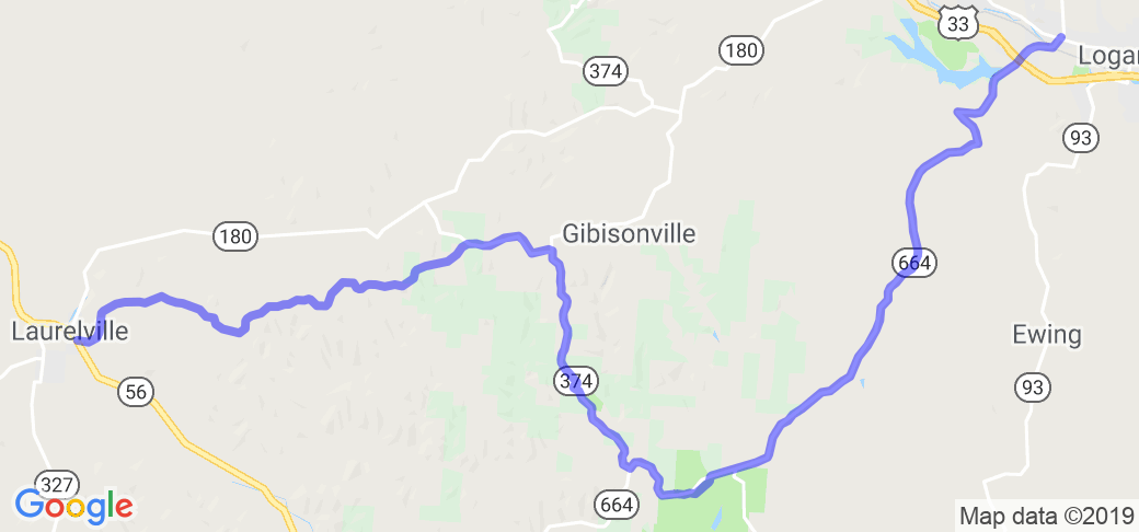
The route starts in Laurelville Ohio. Head east out of Laurelville on County Road 36 which is also called Thompson Ridge Road. Stay on this for about 7.5 miles and it will run into State Route 374 where you want to take a right. Take 374 for about 5.5 miles and it will T into State Route 664. Take a left onto the combined Rt 374/664 as it takes you east/southeast. After about 2 miles, 374 peels off and heads south but you want to stay on Rt 664 as it takes you through Blackjack and in to the end point of Logan, OH.Scenery
Blue Ridge type views to Rock house at 374, down hill run to Big Pine, it follows the creek bottom to 664. Rocky bluffs, streams caves etc. Runs right through the Hocking hills area ... you'll drive through the Hocking State Forest. You also may see some wildlife so WATCH OUT FOR DEER AND OTHER WILDLIFE, BE CAREFUL.Drive Enjoyment
All twisty curvy roads. For the most part 2 lane paved roads, watch for gravel on the right hand turns.Tourism Opportunities
Restaurants at the beginning and end. Rest stops in the parks. Hocking State Forest ... check out their very informative website .Many local craft shops and flea market where 664 ends at Rt 33. The route ends at Lake Logan State Park ... check out their website as well.

