Written Directions
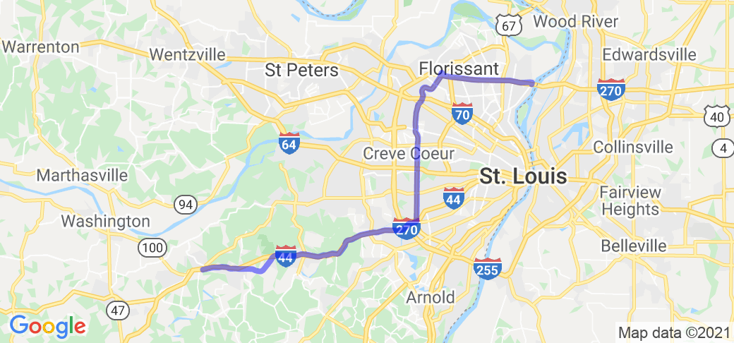
The Starting point is at the entrance to the Chain of Rocks Bridge, 0.2 miles south of the intersection of I-270 and Riverview Dr. (exit 34). Proceed north for 0.3 miles, then turn left on Dunn Rd. Stay on Dunn Rd. for 10 miles. Continue straight as Dunn Rd becomes Taylor Rd for 0.5 miles. Turn left onto Lindbergh Blvd. and follow for 17.3 miles (Lindbergh Blvd will become Kirkwood Rd. as you enter the city of Kirkwood). Take the on-ramp to Watson Rd./MO-366, take the right fork and continue west on Watson Rd. for 0.4 miles. The road becomes an on-ramp to I-44. Continue on I-44 for 15.3 miles. Take exit 261 (Six Flags Rd). Turn left onto Six Flags Rd, proceed under the highway, then turn right onto I-44 Business Loop/Historic Route 66. Continue for 8.8 miles to the intersection of Historic Route 66 and MO-100.
Scenery
The beginning part of the route parallels I-270, and is typical of a "frontage road" for an interstate in an metro area. Lindbergh Blvd/Kirkwood Rd travels around (and under) the west end of Lambert St. Louis Airport (the 1/4 mile tunnel is a good opportunity to listen to your bike's exhaust notes) and through several suburban communities, including historic downtown Kirkwood. The I-44 section is typical interstate, although the stretch over Antire Ridge is notable. Once back on the 1936 route just past the Six Flags amusement park, the road goes past bluffs that were used for mining silica in the 19th and early 20th century, and is more typical of the historic Route 66 roads.
Drive Enjoyment
All of the roads are in good shape, and, with the exception of parts of Dunn Rd, are maintained by the Missouri Department of Transportation. The various sections of the route will be in various states of maintenance, but are generally well maintained.
Tourism Opportunities
The route has many opportunities, starting with the Chain of Rocks Bridge. Be sure to stop at the Missouri Visitors Center just after turning onto Dunn Rd. There are multiple restaurants along the route, many small shops, and historic sites on or near the route. Consult with a St. Louis area or Route 66 tourist guide for all of the attractions. Stopping at the visitors center at the Route 66 State Park (which is on the east side of the Meramec River, while the rest of the park, the former village of Times Beach, is on the west side) is a must - take exit 266 on I-44.
Motorcycle Road Additional info
NOTE: The Google Maps route does not follow the directions, due to the limitation on waypoints. Either use the written directions, or this route in the Harley-Davidson Ride Planner: https://maps.harley-davidson.com/share/rides/XBONe0Yjw
This route follows the 1936 "Bypass" alignment as closely as possible, which was used until the construction of I-270 in 1962 and I-44 in 1964. I-270 between Riverview Dr. and Lindbergh Blvd is on the actual alignment, as is I-44 from the end of Watson Rd to Six Flags.
















 Write a review
