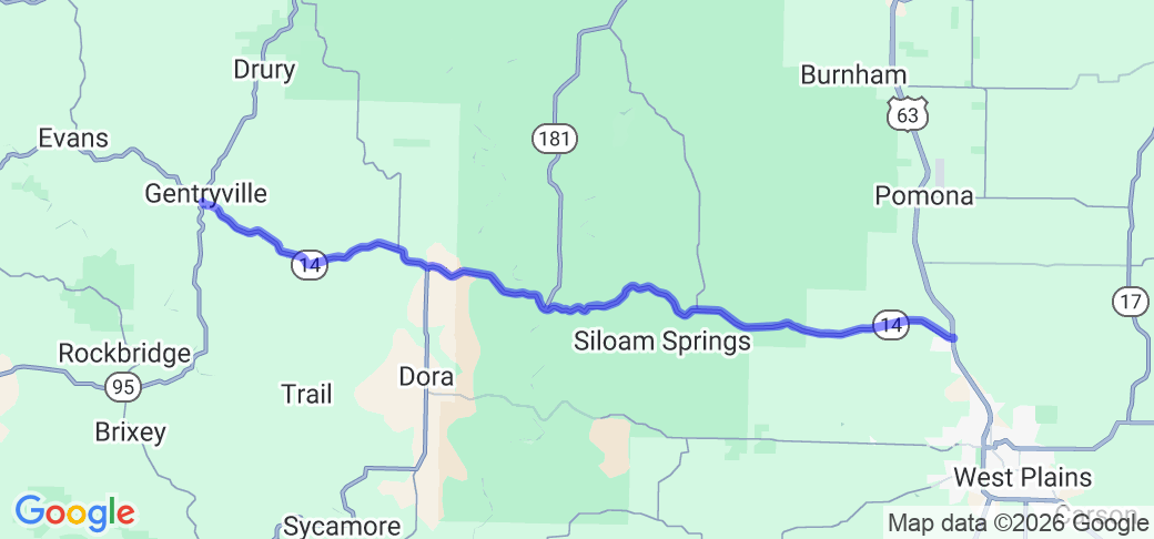
Written Directions
Head north from West Plains, MO on US-63 to the intersection with MO-14 (approximately 4 miles north of the intersection with US-160). Turn left, heading west, on MO-14. Continue for approximately 29.4 miles, to the intersection with MO-95 in Gentryville.
Scenery
The route travels through a mix of forested sections and open fields, running mostly along ridgetops, and occasionally dropping into creek and river valleys, offering some nice panoramic views of the Missouri Ozarks and the Mark Twain National Forest. The views are especially colorful during the fall color season.
Drive Enjoyment
The route travels through the Missouri Ozark hills, providing nearly constant, gentle elevation changes. The route starts and ends with easy sweeping turns, usually in sets of curves with the occasional straight section, while there is a section in the middle of the route with tighter turns and almost no straights, and some blind crests in the middle of some of the turns. The pavement is well maintained rolled asphalt with some large patched sections.
Tourism Opportunities
The only attractions along the route itself are a few historic concrete bridges, the two "Twin Bridges" at the intersection with MO-181 and one as you get close to Gentryville. West Plains at the east end of the route has a number of parks, museums, stores and restaurants, and a number of buildings on the National Historic Register, including the county courthouse and the entire surrounding square. There is a country store in Gentryville.


 Write a review


 | United States")


- Ranch Roads 335, 336,337a | United States")


 | United States")


 | United States")


