Written Directions
From Albany, LA, take route 48 north and near Montpelier, take a right on to route 16 heading northeast. Stay on route 16 and then in Amite City take a left on Old US Highway 51 heading north. Now just stay on Old Highway 51 all the way up as you cross into Mississippi and in to the route's end point of McComb, MS.
Scenery
It is 59 miles one-way. Hope others enjoy it as much as I did. The general scenery you'll see along the way comprises of farm land, timber land, punctuated by old towns, and hills.
For a more detailed rundown of what you'll see on this ride, keep reading. This is a trip I took not too long ago that was surpisingly nice (to me.)
Starting at Albany, LA on Highway 190 or from Hammond, make your way west on Highway 190 to Albany. Albany seems like a small community right out of the 1960s with buildings out of the 1940s, perhaps. I am very curous about the Pentacostal Church sign at Hwy 190 and 43; it's the biggest sign around these parts. Not much to Albany except a very leisurely 35 MPH speed limit (Observe it! Not much to do in Albany but ticket speeders and go to church, I think!)
Once you get on Highway 43 North, the ride improves 100%. Very nice rolling turns, not too sharp, and shaded sections of road. Careful of some occassional logging and farm traffic along this road. You are near timber-leases and farmland here.
Take this road north about 14 miles to near Montpeiler, where you can catch Highway 16 east towards Amite.
The road surface of Hwy 16 is excellent -- you can pick up your pace, and why not? Not much to see but a well-maintained highway with rural pasture land on either side. After about 6.5 miles, you will come to 'civilization' with shopping malls, fast food joints, and I-55 crossing overhead. Don't dispair, don't stop. You are passing this up ...unless you need fuel or want some coffee.
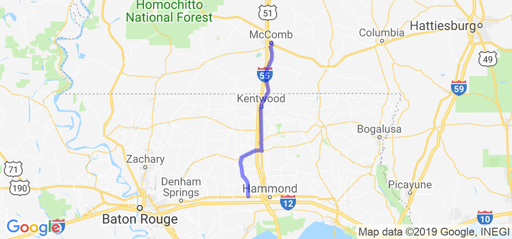
Go about one more mile and you arrive in Amite City's downtown area, which has wonderful old buildings, converted train depot that once served the old IC railroad, and some old houses and hardware stores. It begs one to stop for a few minutes after turning left to go north on highway 51, where a roadside parking area is next to the old train depot and a small municipal park.
Murphy's Family Restaurant and Loco Java Coffee and Tea are nearby here, but if you can, wait! A real treat awaits in McComb at the end of this trip.
Run north along side the railroad up Highway 51 towards Mississippi. You'll pass Roseland, Fluker, Tangipahoa (the town), and Kentwood, all nice (and very small) communities forcing you to slow down a bit and ponder "what do people do around here." I think Kentwood produces 1990s child pop singers, but can only recall one named Britney S-omething or other. Anyway, while you can't really see it at this point, you are also running parallel to the Tangipahoa River to your east. You will get closer to it and I'll mention a detour if you actually want to cross it and risk hitting some deer.
Approximately 19 miles after leaving Amite is Osyka, Mississippi, and this is where Highway 51 starts undulating with a few hills. The hills get progessively more steep, and you'll actually have to slow down in some spots to be safe about potential traffic on the blind hills. This is true at Osyka and about 3.5 miles north of Osyka at Chatawa (St. Mary drive on your right.) Now here is where you can get a glimpse of some old, rural timber land, farms and St. Mary of the Pines if you care to take a right onto St. Mary Drive towards OLD Highway 51. The Detour is not great in condition but it is paved. It will force you to cross the Tangipahoa River at the Chatawa Post Office (next to the river and in the middle of seemingly NOWHERE.) I don't know what people do here these days except maybe pick up their mail.. hunt and drill for natural gas and oil.
This area is where deer will run along the road and possibly in front of you. Careful! It is curvy and hilly so you'll have to slow down quite a bit. This area was settled by old New Orleans families and eventually the Catholic nuns at St. Mary's back in the 19th and early 20th centuries. It was a refuge from the Yellow Fever epidemics and eventually good timber and crop land. And yes, the Tuscaloosa Marine Shale is tens of thousands of feet underground and evidently capably of producing a lot of natural gas and oil... Back to the ride>\.
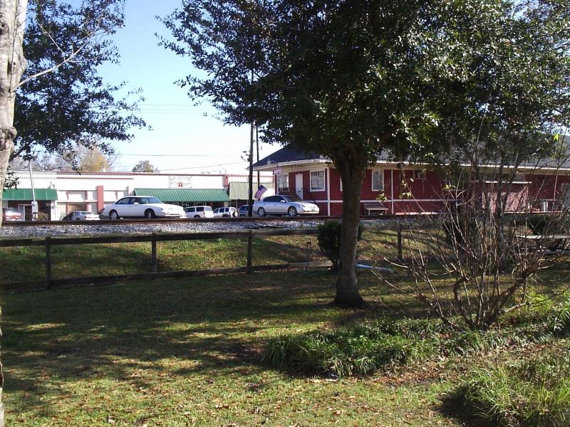
OLD Highway 51 is reached from this detour using St. Mary Rd, where you'll want to turn left to go north into Magnolia. Old 51 forks at Pleasant Springs Rd. (go Left) then turn left again when that road terminates at Centerville. Centerville joins Highway 48 E (take a left yet again), which takes you right into downtown Magnolia, Mississippi.
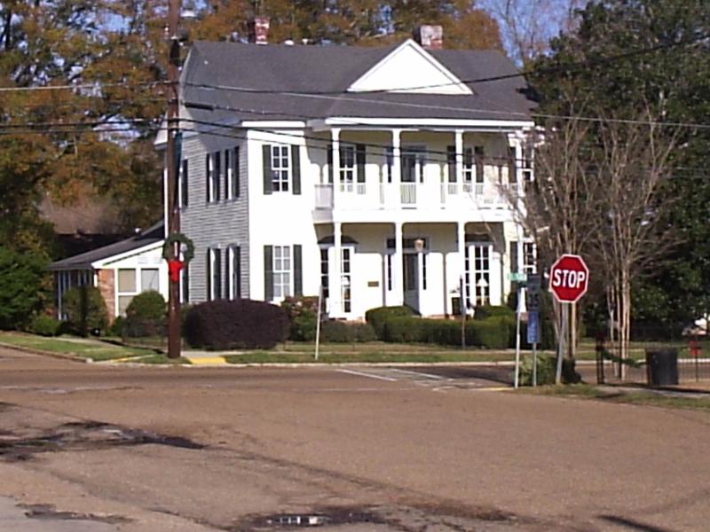
If you opted to stay on the Newer Highway 51, it rolls up and down hills right into Magnolia proper. Nice court house. Nice people. Or, breeze up Highway 51 to McComb if you see it is near 11:00 AM. Hwy 51 turns into S. Broadway Street at McComb. Stay on a bit and take a left at 5th Ave for lunch (11:00 AM to 2:00 PM T - Sun) at the Dinner Bell Restaurant. It's real round-table dining with authentic Southern Mississippi food in an older looking home! Huge lazy-susan buffet style feast to enjoy with total strangers. For large groups traveling and eating together, they request a call ahead or reservations, otherwise, pull in and grab a seat!
Drive Enjoyment
A fair amount of sweeping curves with the road becoming more straight and hilly towards the end. Overall, very pleasant ride.
Tourism Opportunities
Destination is a great little restaurant with a unique round-table buffet style service. Some small city parts and historic cemeteries along the way.


 Write a review


 | United States")


- Ranch Roads 335, 336,337a | United States")


 | United States")


 | United States")


