Written Directions
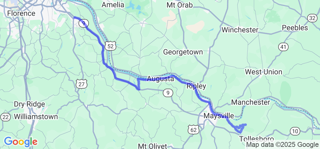
On the north side of Alexandria, Kentucky, grab the AA Highway (KY9) and go east to the intersection of KY1159 - Bladestown Drive (south side)/Wellsburg Walcott Road (north side). Turning north you will see the Walcott Bridge immediately on your right at the bottom of the hill. There is a parking area and a small park around the bridge. You can climb down to Locust Creek and also cross the bridge on foot. Leaving the bridge take the Wellsburg;/Walcott Road north to the intersection of KY8 (aka Mary Ingles Highway). Turning right to go east pass through small communities until you get to Maysville. KY10 joins KY8 on the north side of town and continue east to Rectorville. Turn left (north) on Owl Hollow Road and follow it toward the Ohio River about 1 1/4 miles. The road dead ends on Cabin Creek Road. Turn right (east) on Cabin Creek Road and go about 2 miles. Cabin Creek Covered Bridge will be at an intersection, but it is closed to traffic. There is little parking, but the road is not heavily traveled. You return on Cabin Creek Road to Springdale Road (KY984) which returns you to civilization of the Plumville community where you can pick up KY10/8 and head back toward Maysville about 6 1/2 miles west.
Scenery
You are parallel to the Ohio River as you follow this route, hence you are in the bottom lands that don't have many hills. The roads are curvy and forested dotted with small towns and farms. The Walcott Covered Bridge has a nice local park, but the Cabin Creek in a more rustic setting is on the edge of private property. It's pretty much wilderness there.
Drive Enjoyment
There are peeks of the Ohio River once and a while. Maysville is the largest town once out of Alexandria. The other towns aren't always even named. The area is forested and sweeping curves, not really many twisties, but you are near the river so you are in some quiet farmland. All of the roads are well kept.
Tourism Opportunities
Walcott Park is a great place for a picnic and splashing around in Locust Creek. Cabin Creek is pretty remote. There is plenty of amenities in Maysville for food and gas and at the starting point of Alexandria.
Motorcycle Road Additional info
There were two other covered bridges in the area. Near Dover on Lee's Creek Road is Dover Covered Bridge, but it is in deplorable condition. It seems they started to restore it, but the building supplies, metal and wood, are scattered around in the weeds . Valley Pike Covered Bridge is viewable, but since it is privately owned, we did not go there. The GPS coordinates for all four are:
Walcott Covered Bridge: N 38 43.992 degrees W 084 05.868 degrees.
Dover Covered Bridge: N 38 45.018 W 083 52.719 degrees
Valley Pike Covered Bridge: N 38 40.470 degrees W 083 52.320 degrees
Cabin Creek Covered Bridge: N 38 36.574 degrees W 083 37.277 degrees


 Write a review


 | United States")


- Ranch Roads 335, 336,337a | United States")


 | United States")


 | United States")


