Motorcycle Route Author

By Guest (0 McR Points)
on Apr 30, 2006
Rider Reviews
Written Directions
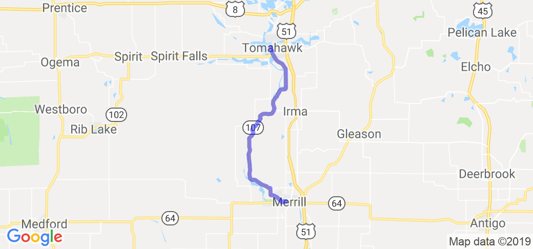
Start your route in the town of Merrill, WI. From there simply head north on highway 107 all the way up to the end point of Tomahawk, WI.Scenery
Hwy 107 is a very scenic road that runs along side the Wisconsin River between Merrill and Tomahawk. Riding along the Wisconsin River you can see eagles and other wildlife. The scenery on this road is always beautiful but its especially pretty during the fall colors. The only thing bad is you really have to be on our tows watching for deer and turkeys.Drive Enjoyment
Hwy 107 is a blacktop road that's in pretty good condition as it was redone a couple years back. This is a slow paced, twisting road that is only around 25 miles long. The roads surface was repaved a couple years ago so its in pretty decent shape.Tourism Opportunities
There isn't really any place to stop and eat or get gas on this 25 miles long stretch of road.Motorcycle Road Additional info
- View the weather forecast for this area from Yahoo weather . - Wisconsin Dept of Natural Resources -
BigRagu
4 McR Points
Motorcycle Type : Touring
A great road for a short run. Lot of turns and good scenery. As always in Northern WI watch out for sand and gravel on the inside corners of the turns. Several small bars for snacks.
Was this road review helpful?
Thumbsup
1 riders found this road review useful

Jean
2 McR Points
Motorcycle Type : Cruiser
This is an awesome road - have taken it many times every year - nice & curvy. If you go, you must stop at Grandfather Falls - the river is funneled into 2 huge tubes that carry it through the hydro plant. You can stop at both ends, about a mile apart. It's really a site to see.
Was this road review helpful?
Thumbsup
0 riders found this road review useful
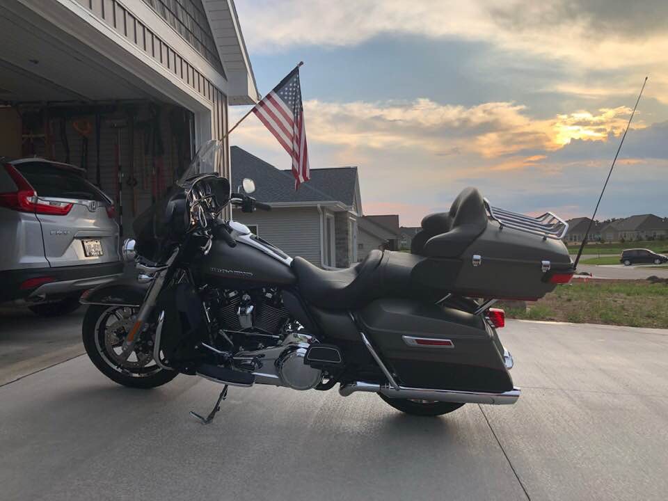
Rhawk17
30 McR Points
Motorcycle Type : Touring
Great fall ride!
Was this road review helpful?
Thumbsup
0 riders found this road review useful

GrumpyKC
10 McR Points
Motorcycle Type :
Great ride
Was this road review helpful?
Thumbsup
0 riders found this road review useful
Photo Gallery of The Highway 107 River Run (0 Photos)
No Photos Or Videos Added Yet.Interactive Views Along This Route
Start point
Latitude 45.18013
Longitude -89.69375
Way point 1
Latitude 45.341528
Longitude -89.759674
End point
Latitude 45.471447
Longitude -89.733582
Most helpful review of this route
Featured video
Newest Motorcycle Roads & Rides

Missouri,United States,
Scenery
Ride Enjoyment
Tourism Opportunities


Missouri,United States,
Scenery
Ride Enjoyment
Tourism Opportunities


Missouri,United States,
Scenery
Ride Enjoyment
Tourism Opportunities


Missouri,United States,
Scenery
Ride Enjoyment
Tourism Opportunities


Kentucky,United States,
Scenery
Ride Enjoyment
Tourism Opportunities


Kentucky,United States,
Scenery
Ride Enjoyment
Tourism Opportunities


Missouri,United States,
Scenery
Ride Enjoyment
Tourism Opportunities


Kentucky,United States,
Scenery
Ride Enjoyment
Tourism Opportunities


Kentucky,United States,
Scenery
Ride Enjoyment
Tourism Opportunities


Kentucky,United States,
Scenery
Ride Enjoyment
Tourism Opportunities


Best Motorcycle Roads & Rides

Tennessee,United States,
Scenery
Ride Enjoyment
Tourism Opportunities


Tennessee,United States,North Carolina,
Scenery
Ride Enjoyment
Tourism Opportunities


Texas,United States,
Scenery
Ride Enjoyment
Tourism Opportunities


Montana,United States,Wyoming,
Scenery
Ride Enjoyment
Tourism Opportunities


Virginia,United States,North Carolina,
Scenery
Ride Enjoyment
Tourism Opportunities


Ohio,United States,
Scenery
Ride Enjoyment
Tourism Opportunities


North Carolina,United States,
Scenery
Ride Enjoyment
Tourism Opportunities


Arkansas,United States,
Scenery
Ride Enjoyment
Tourism Opportunities


Michigan,United States,
Scenery
Ride Enjoyment
Tourism Opportunities


Colorado,United States,
Scenery
Ride Enjoyment
Tourism Opportunities


Wyoming,United States,
Scenery
Ride Enjoyment
Tourism Opportunities


Arizona,United States,
Scenery
Ride Enjoyment
Tourism Opportunities


South Dakota,United States,
Scenery
Ride Enjoyment
Tourism Opportunities


Georgia,United States,
Scenery
Ride Enjoyment
Tourism Opportunities


Arkansas,United States,Oklahoma,
Scenery
Ride Enjoyment
Tourism Opportunities


Ohio,United States,
Scenery
Ride Enjoyment
Tourism Opportunities


Virginia,United States,
Scenery
Ride Enjoyment
Tourism Opportunities


California,United States,
Scenery
Ride Enjoyment
Tourism Opportunities


Arkansas,United States,
Scenery
Ride Enjoyment
Tourism Opportunities


Alabama,United States,Mississippi,Tennessee,
Scenery
Ride Enjoyment
Tourism Opportunities


Popular Motorcycle Places

Jamies Outpost is a LARGE bar with lots of parking. Live music on weekends, great food and drinks…
Log Cabins, RV sites, Tipi's and tent camping in the Texas Hill Country. Was built by bikers for…
Rock and Roll Motorsports Bar and Gastro Pub with craft beer and good food! Sulphur Springs…
Popular Motorcycle Clubs
Earn McR Points
Help keep MotorcycleRoads.com free by:
Accumulate MCR profile-points to increase your Rider Status
- Use our sharing links on the page to notify other riding friends about great roads, events, clubs, & places & earn 1-profile point per share!
- Add likes, star-ratings, comments about a route, event, club, or place & earn 2-profile point per activity!
- Add a route to your wish-list or route’s I’ve ridden list and earn 2-profile points per add!
- Add a photo or video to a route, event, club, or place and earn 3-profile points
- Add a new route, event, club or place and earn profile 5-points! (must be reviewed, approved, & posted)
What to look for


 Write a review

