Written Directions
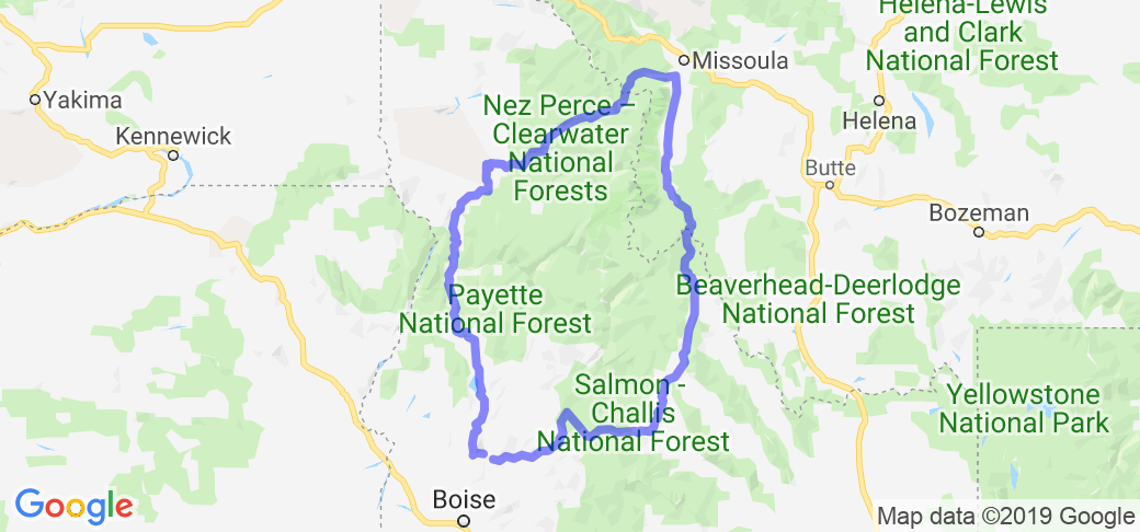
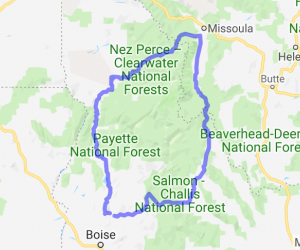
This is a loop and therefore can be started at any given point but for the purpose of this description, we will start at Stanley. Follow the Salmon river East out of Stanley on ID-75 to US-93 in Challis. Continue on US-93 through Salmon and up over Lost Trail Pass into Montana. Continue on US-93 North through Montana following the Bitterroot River to Lolo. Turn West at Lolo on US-12 and cross into Idaho over Lolo Pass. Follow the Lochsa/Clearwater Rivers West to Kooskia. Turn South on ID-13 to Grangeville. Turn onto US-95 at Grangeville and follow the Salmon River heading South. Continue South through Riggins before veering East at New Meadows on ID-55. Follow ID-55 South through McCall. At Banks, take the Banks/Lowman Road (Wildlife Canyon Scenic Byway) following the South Fork of the Payette River heading East. At Lowman, continue east on ID-21 through the Boise/Challis National Forest to Stanley.
Scenery
This route takes you along the banks of the Salmon, Bitterroot, Lochsa, Clearwater, and Payette Rivers. You will see some of Idaho's most prized natural resources: dense forests, desolate deserts, mountains of varying composition and stature with towering summits, deep foreboding canyons, pristine lakes, abundant wildlife, and numerous creeks and rivers. You will travel along both legs of Lewis and Clark's routes through Northern Idaho/Western Montana. You will also see World famous Salmon and Stealhead fishing waters as well as world renowned rapids for white water rafting. You will drive through the Sawtooth Scenic Byway, Ponderossa Pine Scenic Byway, Salmon River Scenic Byway, Northwest Passage Scenic Byway, Payette River Scenic Byway, and the Wildlife Canyon Scenic Byway.
Drive Enjoyment
This is only a trip for riders that love twisties! I do not believe there is a stretch of over 5-10 miles without some sort of bend in it (at the top of Lolo pass on the Idaho side, there is a sign that reads "winding road next 99 miles"). The route follows US and State highways from start to finish (with the exception of the Wildlife Canyon Scenic Byway between Banks/Lowman). The road is very well managed during the warm months with very little traffic (traffic will be more of a problem during certain times of the year). Wildlife and cattle can be a problem in some area's so it is best to ride defensivly at all times.
Tourism Opportunities
This route will take you through many small mountain towns, each with their own personality and historical significance; you will also travel through the Nez Perce Indian Reservation. There are plenty of turn offs for camping, fishing, and scenic viewing along the way. From start to finish, you will encounter numerous markers of historical significance, be that ancient geological history, people of early state significance, or sights of historic US/Native battles. If you prefer to stay in hotel lodging as opposed to camping, there are several inn's/lodge's along the banks of the rivers that are clean and resonably priced. There are also plenty of hot springs (both developed and undeveloped) along the way. If necessary, greater civilization is a short drive off the path on each courner of the trip and can be accessed with a short drive of 1 hour or less (Missoula, Lewiston, Boise, Sun Valley).















































 Write a review
