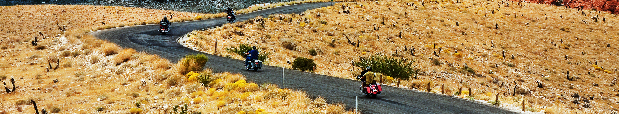
Motorcycle Roads in Oklahoma
Motorcycle trips in Oklahoma's (OK) will feature scenery dominated by flat to rolling hills of various forms of prairie grasslands as three quarters of the state is blanketed by prairie grasses (one quarter of the state is considered forested). On a rod trip riders will see elevations that vary from the state's low point in its southeast corner (at only 800 feet above sea level) and rise as you move west into the panhandle where the highest peak resides - Black Mesa at 5,000 feet above sea level. The state has four primary mountain ranges: the Ouachita Mountains, the Arbuckle Mountains, the Wichita Mountains, and the Ozark Mountains. And, the state is home to the most number of man made lakes in the US at 200.
 | United States")
It's the highest hill in the world so the views are all spectacular. Two good spots for photo ops.
3 out of 5
Rider Rating


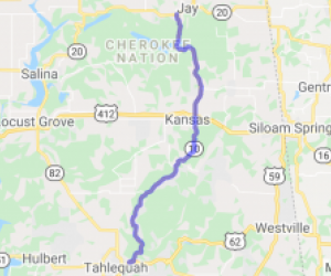
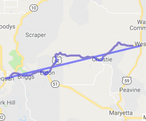
Easy riding "touring" ride through rural KS and OK. This is a Southeastern Kansas, north to south loop that is very scenic. The ride also extends briefly down into northeastern Oklahoma as it swings…
2.5 out of 5
Rider Rating

Twisty road through eastern Okla Forest. One of the more scenic drives in the entire state of Okla.
4 out of 5
Rider Rating

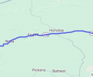
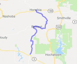
Winding curves through the Cookson Hills interspersed by stretches through valleys where you can open it up a bit. Vistas are constantly changing. This is a great 18 mile route & connects…
4 out of 5
Rider Rating

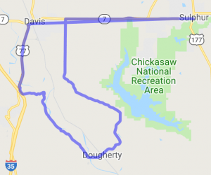
See the Arbuckle Mountains up close and personal, as well as the beautiful farm land around the Washita River Valley. The route starts in Davis and can be taken to Sulphur and looped back again.…
3 out of 5
Rider Rating

You are driving along US 412 and there is pretty much nothing to look at and then all of sudden you enter about a 25 miles stretch of desert looking plateaus. Once you get on U.S. 412 in Orienta,…
3 out of 5
Rider Rating

The trip covers mostly rolling plains until you get to Anlers and go north on highway 2. At this point the scenery becomes a 5 due to the large pines with a series of nice twisties. Definately a…
3 out of 5
Rider Rating

This route takes you through scenic countryside in Oklahoma - just west of the Ouachita Mountains, but still hilly and very rural.
1 out of 5
Rider Rating

This run leads west out of OKC running 3 mi. North of & parallel to I-40 for 20 miles. To start, Lake Overholser is to the south. There's an old iron bridge right off the main drag, making for a…
1 out of 5
Rider Rating

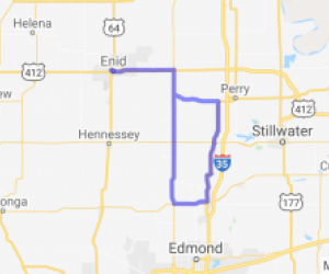
Leaving Enid Ok. It's pretty much flat to Guthrie Ok. good roads some rolling hills. We had some people to visit in Guthrie so we didn't do the tourist thing. Headed out of Guthrie on 77 N to Mulhall…
Route has not been rated yet

There is nice deep tree cover in spots which will cool it down in the summer. The road levels out to some plains (it is OK after all) and is mostly flatter with a few ups and downs.
Route has not been rated yet

There are no developed areas on this route. Your views will be sweeping vistas and tree-lined twisty road.
Route has not been rated yet

The route follows the natural rolling hills of this part of Oklahoma, with a mix of open fields and woods, with some nice panoramic views of the valleys from the tops and bluffs of the ridges.
Route has not been rated yet

This route crosses a mountains and valleys of southeast Oklahoma, nothing incredibly steep, but still great views. This route starts with a lot of forestland and dirt roads that have a little traffic…
Route has not been rated yet

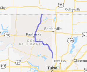
Nice little two-lane twisty ride that follows the dips and turns of Osage County with nice vistas and Osage Nation historical sites including easy side trips to Pawhuska, OK, capitol of the Nation…
Route has not been rated yet

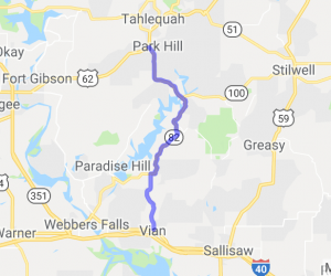
You will pass through forests, hills, and take in views of Tenkiller Ferry Lake.
Route has not been rated yet

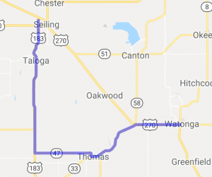
If you're crossing northwest Oklahoma, this route is a welcome diversion from the boredom of US 270 and well worth the detour. On the east-west leg, you'll have good undulating road through river…
Route has not been rated yet

I rated the scenery as a 3 because the ride is so short. It's pretty, with trees marking both sides of the road. There's certainly wildlife to see as well, so watch out for deer!
Route has not been rated yet

Rolling hills and valleys, plenty of pines for the passenger to watch fly by, may be a deer or two along the way.
Route has not been rated yet

This follows the Gypsum Hills Scenic Byway. You'll see great views of Gyphills (AKA Gypsum Hills). This area includes large canyons, red rocks and soils, open country, and grasslands. Scenic Byway…
Route has not been rated yet