Written Directions
The easiest way to find the road is to head out of Franklin, NC heading west on Highway 64. About 5 miles out of town, you'll see a sign for Wayah Bald/LBJ Job Corps. The road is Patton road, but it may not be signed. It's a right hand exit ramp off Hwy. 64 onto Patton Road. Pretty much immediately after getting off 64, you'll see an abandoned gas station at the intersection with Wayah Road.
Now-Wayah road is already on this website, and is a fun road in itself, but we're after a larger prize.
After turning left at the old gas station, continue on Wayah Rd. for 10.7 miles. You'll eventually crest over the top (where the Appalachian Trail crosses the road) and start heading downhill. Once you're heading downhill, you're looking for the first road on the right.
There will be a sign for Dirty John Shooting Range. That's where you turn, and that is the start of the road.
There is a sign up that warns of broken pavement for the next 15 miles. Don't mind it. The first 7 miles or so of the road are freshly paved.
Go ahead and turn it loose at this point-the road twists and turns through some beautiful hills with trees lining both sides of the road. It's truly beautiful in the fall.
After approximately 7 miles, you'll come upon an overlook/pulloff in a right hand turn. This is the end of the fresh pavement and offers incredible views of the valley and lake below.
At this point, if you're comfortable riding on gravel and broken pavement, you could continue on for another 8 miles or so to where the road intersects Cold Springs Creek road, and use that to join back up with Wayah Road, or turn around and ride the 7 miles back, enjoying the twists and turns again in reverse.
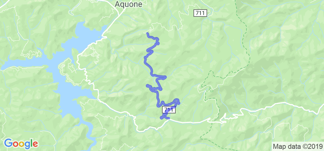
Here's a link to a map of the road section I'm talking about: https://tinyurl.com/WinespringRoad
Scenery
Hey guys-I'm local to Franklin, NC and figured I'd let you in on my dirty little secret...its one of the most beautiful and technical roads in WNC, and most of the time, it's completely deserted! No intersections, no houses, and no cops. Just a shooting range and a horse camp.
Most of the early part of the road is pretty heavily forested, with a few small streams that cross under the road. After about 4 miles, the view opens up a bit and you'll come across a couple overlooks that offer insane views of the valley and lake below.
Drive Enjoyment
The road has a nice combination of tight switchbacks and long, fast sweepers. As mentioned earlier, the first 7 miles are freshly paved without ANY potholes at all. Very smooth, fast road. However, after the second overlook, the road turns into broken pavement and gravel. If you're on an adventure/enduro bike, you could make it through no problem, but I wouldn't take a cruiser down the road. I've done it in a Miata before, but it wasn't fun.
Tourism Opportunities
Once you get this far up in the hills, there's nothing around for miles. Be sure to tank up in Franklin or else you'll be coasting down the hills.
Motorcycle Road Additional info
This video submitted by Jared in Oct of 2014:

















 Write a review
