Motorcycle Route Author

By Guest (0 McR Points)
on Dec 31, 2006
Rider Reviews
Written Directions
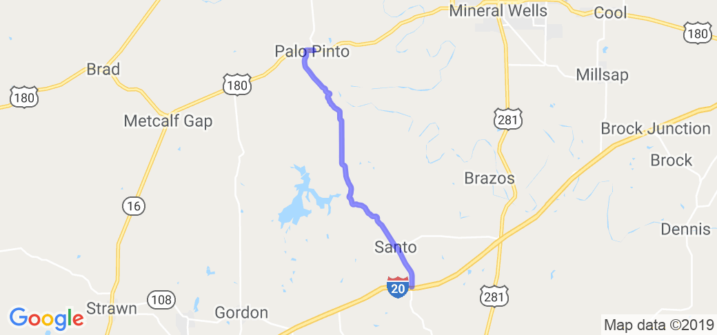
Start in Palo Pinto, TX which lies about 60 miles west of Ft. Worth. From Palo Pinto simply take Santo Hwy (AKA Route 4) south down to and through the town of Santo, TX. Continue a short while past to Interstate 20.Scenery
Sort of short but worth the gas. Excellent scenery set in rolling hills with tree lined 15 mile stretch of "real purty" starting in the town of Palo Pinto. The best scenery ends at junction of Interstate 20. Overall it's a "mini" version of some great hill country type cycling.Drive Enjoyment
All paved, smooth single lane road with winding roads and some fairly nice turns and inclines. Keep in mind there is almost no shoulders and limited pull offs for camera opsTourism Opportunities
No parks or attractions other than scenery. Small "quick" type store w/gas in towns of Lone Camp and Santo. For example in Lone Camp you can find cold drinks, restrooms and hot snacks/food at a small store (approx 10 miles in) or continue on another 4-5 miles to Santo for the same amenities.You will also pass by Palo Pinto Reservoir and may want to stop by and take in the lake scenery or some fishing. There are also some bed and breakfast type places on the reservoir.
By the way, if you are heading out to this route from Ft. Worth, you'll pass through Mineral Wells, TX. If while in Mineral Wells, you find yourself hungry, I would recommend Pulidos Mexican Restaurant or any of the many other "eateries" in that area.

