Written Directions
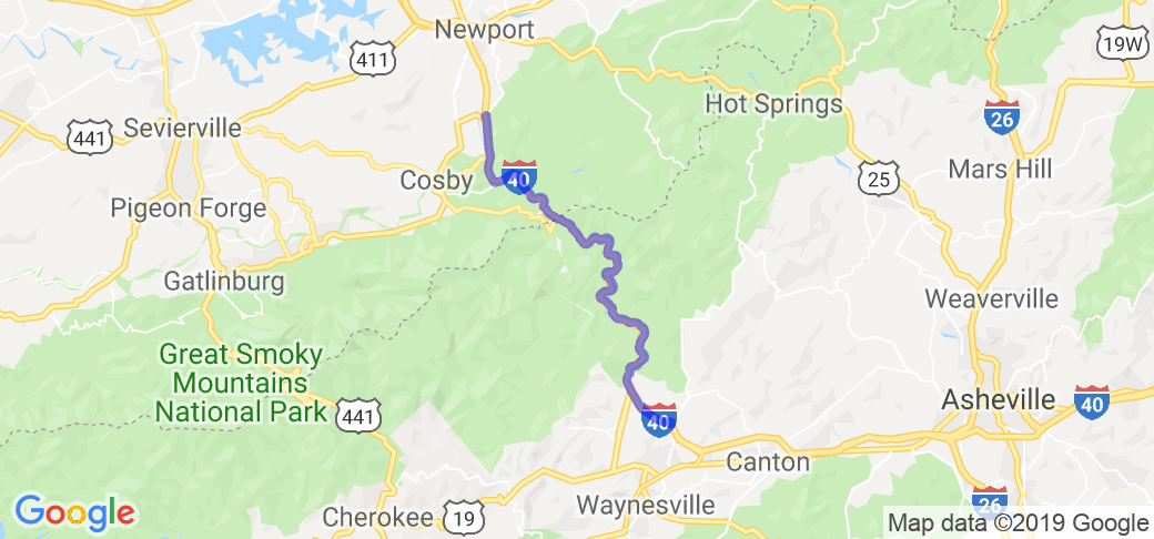
This route is a seriously fun, high speed, twisty run on Route 40 along the Pigeon River with the north point being at the edge of Cherokee National Forest in Tennessee, and the south point being at the edge of the Pisgah National Forest in North Carolina. While it is a section of interstate and typically not thought of as fun on a bike, this section is beautiful and best experienced with a bit of extra throttle. Your ride can either run north or south; both are excellent. The north point starts at the intersection of the Foothills Parkway (also an amazing ride) and R40 in Tennessee. The south point is the intersection of R40 and R276 (Jonathan Creek Rd) in North Carolina.
Scenery
This route runs through the Appalachian Mountains just to the east of the Great Smoky Mountains National Park. It is four-lane divided highway following the Pigeon River through a pass in the mountains. Along the way you will see lakes, rivers, creeks, boulders, and deep forest. During October, the fall colors are outstanding.
Drive Enjoyment
The quality of the tarmac is perfect. This is a high-speed highway after all. There are lots of bridges along the way, all well maintained. Even though this route is through the Appalachian Mountains, it is primarily flat as it runs along the Pigeon River and you are surrounded by mountains. It is a curvy ride, really run at some speed.
Tourism Opportunities
You are riding through National Forests. Please expect no amenities at all during the ride. It is a good idea to gas-up before you start. There are two highway rest stops going north (one is a replica of Dolly Parton's childhood cabin) and one rest stop going south. At the north end in Hardford, TN are two gas stations. The BP to the west has good fries. The south end of the ride is in the middle of nowhere, but R276 quickly leads to Maggie Valley, NC, where you'll find touristy hotels, motels, and restaurants. Also in the same direction is Waynesville, NC, home of BearWaters Brewing, Headwaters Brewing, and Frog Level Brewing. Several bike shops are close by: Steve's Cycle Center and E-Z Rider Cycles further down the road.



























 Write a review
