Written Directions
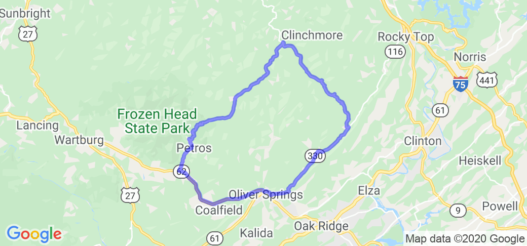
Note: this route was originally referred to on McR as "" yet later, the route had taken on the formal/quasi-official name of "Devil's Triangle" (https://devilstriangletn.com/). State Route 116 in Tennessee runs from its junction with State Route 62 at its southwestern end between Wartburg and Coalfield in Morgan County, to its northeastern end at Caryville, Tennessee in Campbell County. From its southwestern terminus it heads northeast and passes through the town of Petros and past Brushy Mountain State Penitentiary. Continuing northeast into Anderson County, the highway then passes through remote mountainous country known for its many former coal mining villages, some of which were company towns and are now essentially ghost towns. Among them are the towns of Fork Mountain, Buffalo, Devonia, Braytown, Rosedale, and Charley's Branch. The Devonia post office which served this entire region was closed in 1975. Once the mines in these towns closed down with the resulting loss of population, the towns' schools were closed and remaining students were consolidated into the Rosedale school, which saw steadily falling enrollment and was closed in the 1990s. This section of Route 116 parallels the New River and the former line of the Tennessee Railroad. There are many abandoned underground coal mines, coal tipples, and railroad yards and sidings along this section of Route 116. Despite the end of most underground mining and the demise of the towns along this portion of the highway, a great deal of strip mining continues however. Route 116 briefly passes into Campbell County and then turns southeast back into Anderson County. From there it passes through the village of Stainville and continues southeast through some remote, sparsely populated mountains to Laurel Grove. There it turns northeast again at the junction with Frost Bottom Road, since 1982 designated as State Route 330. This section of the highway parallels Walden Ridge to the immediate southeast, and a former spur of the Norfolk Southern Railway (now closed), and passes through Briceville, Fraterville which was the site of a 1902 mine explosion, "The Wye" near the former mining camp of Beech Grove, and finally through a gap in Walden Ridge to enter Lake City.
Scenery
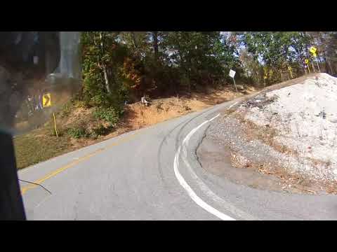
From gentle country road sweepers to gnarly steep switchbacks; from serene straights to Dragon like twisties with guard rails of death; from gentle pull-offs to three foot deep rock strewn gullies just inches from the pavement; from peaceful farmsteads to sections of rutted roadway right out of a horror movie.
Drive Enjoyment
Country road sweepers to gnarly steep switchbacks. Road quality is fairly good, has some patch work in a few areas.
Tourism Opportunities
Very few areas to stop to grab something cold to drink or something to eat. Best place is in Oak Ridge or in Petros before you start heading up the mountain.


 Write a review


 | United States")


 | Kentucky")
 | United States")


