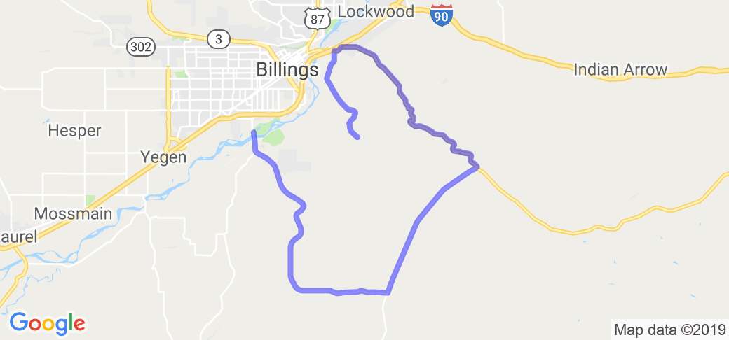
Written Directions
Start at Riverfront park in Billings, MT. Head south on Blue Creek Road. After about 13 miles, you come to a T-junction. Turn left onto Pryor Road (AKA State Secondary Hwy 418).
After about 7 miles, you reach another T-junction. Turn left onto Hardin Road, aka Old US Highway 87. There are some wonderful windy parts in here, but be careful for gravel, and of the blind turns.
You will eventually come into Lockwood and go past the school. When you reach the stop sign, turn left onto Highway 87 East.
After about half a mile, and a hundred feet before the freeway overpass, turn right onto Coburn Road. Follow this for about 5 miles until you reach the Pictograph Caves.
Scenery
This route takes you past Riverfront park, over the Yellowstone River, through Blue Creek, and along the winding road toward Pryor. It then heads up toward Lockwood, by way of the old highway. Lots of slow sweeping turns, long straightaways, and tight winding curves. Not the greatest scenery, but probably the best driving road in the county.
Drive Enjoyment
Blue Creek Road, Old Highway 87, and Coburn Road are in decent shape. But Pryor Road is patchy and narrow. Thankfully, you aren't on it very long.
Tourism Opportunities
The purpose of this route is to get you out of town. However, towards the end, you do come past a few gas stations. And the route comes to an end inside the PICTOGRAPH CAVE STATE PARK .


 Write a review


